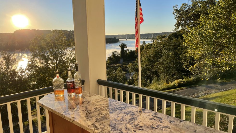
In over 25 years of cruising, we found the waters along the Gulf Coast from Galveston to Carrabelle to be some of the more scenic and tranquil in which we have traveled. The people are friendly, and the waters forgiving — if you pay attention to weather and navigation. It is a pleasant trip, and anchorages abound in most areas. However, for our purposes, we will provide you with our favorite anchorages, traveling west to east.
We like to travel about 50 to 60 miles per day, leaving one anchorage early in the morning and arriving at the next by 3:00 p.m. or so in the afternoon. In the fall, this is important, so you get into your anchorage before the sun starts going down. In the summer months, it is of vital importance to get in and settled before any afternoon thunderstorms that might (and will) pop up. Some of the anchorages are spaced more closely together than others. We like to find spots that are good jumping-off or arrival points after crossing or preparing to cross large bodies of water.
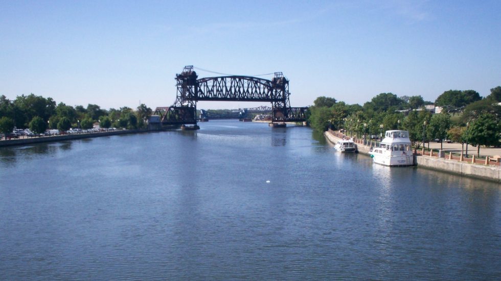
Upon leaving Galveston Bay at SM 350 WHL, you will not find any anchorages for the first 60 miles unless you get very creative. Get an early start from the Port Bolivar area as you begin your eastward trek. Between there and Mobile Bay, much of the traffic you encounter will be commercial and not pleasure boats. Note that west of New Orleans the Statute Mile (SM) is given as WHL or West of Harvey Lock, to denote the distance from there to Harvey Lock in New Orleans.
Taylor Bayou Outfall Canal (Port Arthur, TX area) GIWW SM 290 WHL – Head north in the canal until you reach the wide branch that leads off to the northwest. Take that turn to port and go until you feel comfortable to anchor. This is a very restful stop a little more than a mile off the beaten path with good depths and holding. You will have wave and wake protection here from the marsh grass, but little wind protection. A refinery nearby will be your view.
Adams Bayou
Adams Bayou (Orange, TX area) GIWW SM 267 WHL – Just before you leave Texas waters, head north in Adams Bayou. Our favorite spot to anchor is up near the fixed bridge. There will be some small boat traffic here as workers prepare to head offshore to the oil rigs, but they are generally respectful and slow down as they pass. You should be able to find a spot to go ashore here. This anchorage is lined with trees east and west, and the bridge to the north. The old disused marina continues to fall further into disrepair.
Calcasieu River (Lake Charles, LA area) GIWW SM 241 WHL – At Chopique Island, turn north into the Calcasieu River and go for a couple of miles to until you see the Haymark Terminal to starboard. You can enter the oxbow at either this or the far end and anchor in the area marked 16 feet on the chart. It’s a quiet spot off the waterway and away from wakes. You may also be rewarded with a roseate spoonbill sighting. Other than the terminal, the rest of your view will be of marsh nearby and trees in the distance.
Mermentau River (Lake Arthur, LA area) GIWW SM 202 WHL – Entering the river at RG N “M,” proceed upriver to just beyond G “5.” At that point, turn southeast and anchor behind the tree-covered island in the area marked “Stump PA” on the chart. This keeps you out of traffic heading upriver to Lake Arthur, located another 12 or so miles farther along. This is a very pretty anchorage with many tall trees around. Although the chart doesn’t indicate depths, we found no issues with a 6-foot draft.
Avery Canal/Bayou Petit Anse (Vermillion/Weeks Bay area) GIWW SM 146 WHL – Either of these spots will do for an overnight anchorage located in the marsh off of Vermillion Bay. We generally chose Avery to the south, as it tends to be wider. Setting the anchor is very easy in this thick mud. You won’t have great wind protection, but the marsh will protect you from wakes. You may also be rewarded with a beautiful sky at sunset.
Charenton Drainage Canal (Mud Lake area) GIWW SM 123 WHL – This, as with the next anchorage, is a place where you want to be well out of the way of commercial traffic and also be very visible. We found having an AIS on board invaluable to our safety. Tows could see us clearly during the day. We didn’t have to go far upriver, just to a wide enough spot to pull off and anchor bow and stern next to the treeline.
Bayou Black
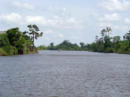
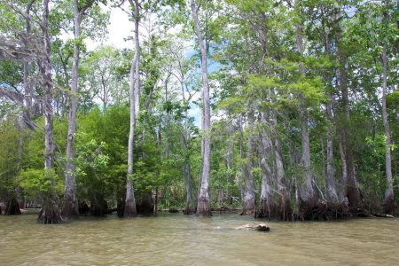
Bayou Black (Bayou Black – Cocodrie) GIWW SM 84 WHL – Heading north for over a mile in the channel, anchor off to the right, bow and stern. This area is heavily trafficked by tugs and barges, so you want to make sure you don’t swing out into the channel and interfere with their navigation. In this area, it is of vital importance to make sure you are visible at night. We chose to add solar lights attached to stanchions in addition to the anchor light for extra visibility. This pretty, cypress-filled bayou offers good protection. Don’t be surprised if you hear or see eagles while you are here.
Lafitte (Barataria Waterway) GIWW SM 15 WHL – Enter from either side of the little island from the Intracoastal at the Barataria Waterway. Anchor on the west side of the channel beyond the charted pipeline area in the wide area of the bend. This was only an overnight anchorage and was not used as a place to go ashore or explore. (For that, we chose a marina in New Orleans.) A number of smaller homes and trees line the shore on both sides.
Note that east of New Orleans, the Statute Mile (SM) is given as EHL or East of Harvey Lock to denote the distance from there to Harvey Lock in New Orleans.
Blind Rigolets (Rigolets – New Orleans Cut) GIWW SM 33 EHL – Although many prefer to use Rabbit Island as anchorage, we like the Blind Rigolets. Anchoring was easy and straightforward. We entered from the GIWW and made sure we left enough room between us and the barrier before the railroad. Trains are the only sound that will disturb the quiet here, and we don’t mind occasional train noise. Marsh grasses and the rise on which the train trestle is built afford fairly good protection.
This is a great overnight spot for those preparing to head across Mississippi Sound or to rest overnight when about to tackle the New Orleans area and its swift river currents, numerous bridges and locks. If you don’t feel comfortable here and don’t mind anchoring in very deep water, an alternative is back at GIWW SM 15 at the Michoud Canal. Anchor in the basin at the very end of the canal. You won’t be able to pay out much scope, but we have used this anchorage in a pinch.
Cat Island (Mississippi Sound) GIWW SM 65-70 EHL – Head off in a southerly direction toward the 9- and 10-foot soundings near Little Bend. This sandy island affords decent southerly protection from the dunes and some trees and bushes, but little to no protection from any other direction. We have strictly used this anchorage as an overnight stop and nothing more. You can find a spot ashore to land a pet if needed. Needless to say, we don’t venture out across Mississippi Sound in either direction unless we have a good weather window to make it all of the way from the Rigolets in Louisiana to the Orange Beach area in Alabama. Should you need to seek cover, head northwest toward St. Louis Bay.
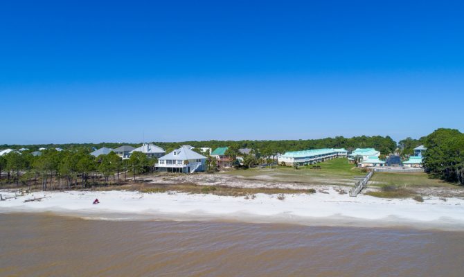
Dauphin Island (Mississippi Sound) GIWW SM 119 EHL – Near R “40” and G “41,” head due south and anchor as close to shore as depth allows. This anchorage would be untenable in strong winds from any direction other than south. There should be a spot ashore to land if necessary. Much of the island at this end is colorful vacation homes built on stilts, but few trees.
Roberts Bayou
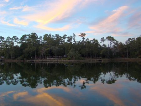
Roberts Bayou (Orange Beach, AL area) GIWW SM 165 EHL – Although this anchorage is only about 10 miles before the next one, it is a separate and distinct favorite anchorage of ours for different reasons. It offers 360-degree protection from any kind of weather, it is pretty with tall trees and attractive homes all around and there is a burger joint, Pirate’s Cove, located conveniently at the entrance to the bayou. The entrance channel is narrow and shallows quickly on both sides, so should be taken at idle speed to avoid grounding and to not unduly alarm any people or dogs that may be swimming in the water right next to the channel. There is a park on the northern shore of the anchorage where one could land a dinghy.
Perdido Key (Pensacola, FL area) GIWW SM 174 EHL – You will find a theme with our favorite anchorages: beaches are always a plus. We have anchored anywhere off the channel on either side near R “16” or G “15” depending on wind direction, boat traffic, etc. We tend to use the green side of the channel if we plan to go across the dunes to the beach and the red side for sitting out afternoon thunderstorms in the lee of the homes and docks on that side of the waterway. Alternately, you can travel farther east to anchor anywhere depth allows around Redfish or Spanish points behind the dunes. The brave-at-heart can enter the area marked “Spoil area” on the chart and find decent depths for quicker access to Ft. McRee. Dinghy ashore anywhere along the beach.
Hogtown Bayou (Destin, FL area, Choctawhatchee Bay) GIWW SM 242 EHL – Keep in mind that only those of you who can pass under the bridges with height restrictions in Ft. Walton and again near Panama City will be able to take advantage of the anchorages in Choctawhatchee. Otherwise, you’ll be heading offshore at Pensacola and coming back in at Panama City. We chose Hogtown Bayou for its long distance from the course line through the bay. Anchoring near the mouth of Churchill Bayou as far in as depth would allow gave us a very comfortable night’s sleep. There are some lovely homes ashore surrounded by stately trees. Other boats were anchored nearby as well.
Alternately, to the north and west are Boggy and Rocky bayous. The basin at Nelson Pt. offers best southerly protection, but really all around. And Toms Bayou off of Boggy Bayou provides a sheltered little cove in 13 feet of water. Head west from Red “8” to access this anchorage. There is a park just to the north where one would be able to land a pet.
Watson Bayou (Panama City, FL area) GIWW SM 293 EHL – The best thing about Watson Bayou is that it provides so many choices! Don’t be alarmed by the narrow appearance of the channel. It is plenty deep. Just follow the deeper water color into the bayou and you’ll have the very protected, but small, Lake Van Vac to the west (depths as charted) surrounded by lovely homes on hilly lots. Or travel farther north to anchor near the fixed bridge. Find a place to land the dinghy and walk to provision from here. As property use here has changed many times over our years traveling this area, check to make sure you land in an approved spot. And we would be remiss if we didn’t mention Pearl Bayou as an alternate for heavy weather. Tucked down near the 50-foot Dupont Bridge, it is a veritable hurricane hole, not to mention a pretty little cove well protected from all directions by trees.
White City (Port St. Joe, FL area) GIWW SM 329 EHL – White City is not an anchorage but a free dock. Deeper-draft boats should stay out on the ends of the docks or at the floating dock that runs parallel to the canal. While there is no electric, there is potable water here and trash cans. It is also a very easy spot to land pets. A convenience store up the road has a limited supply. There is the expectation that you should only stay here one night. The bridge itself offers good wind protection from the west, and the tall trees on both sides of the canal protect from all other directions. You may get the occasional discourteous boater who decides to not slow down through the bridge and dock area, but they are, thankfully, not that numerous.
Saul Creek (Apalachicola, FL area) GIWW MM 345 EHL – We love this quiet spot just off the Jackson River 6 miles northwest of Apalachicola. We have sat out many a weather front here and love its peace and solitude. It is surrounded by trees, and there is nothing nearby, which is why we like it. An alternative anchorage would be just across the river from Apalachicola; however, currents run swiftly here and you will have to put up with wakes.
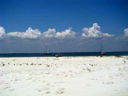
Dog Island (Carrabelle, FL area) GIWW MM 376 EHL – Dog Island is another favorite for many reasons. We love beaches, and it is all beach! It generally only offers protection from the south, unless you decide to travel farther east for tree cover. Also, it makes a great jumping-off point for your offshore run to the Tarpon Springs/Clearwater area. Carrabelle is just a few miles away if you need to run in the big boat to provision one more time before heading offshore. There are a few spots in town where you might be able to anchor as well, keeping a wary eye for numerous shoal spots throughout.
There are so many more anchorages than what we have listed that you will find along the way, but these should get you nicely across the upper portion of the Gulf of Mexico.
For the more detailed information please check out The Great Book of Anchorages by Susan Landry and Chuck Baier